Šta je novo?

„Satelitski pogled“ na Beograd

trialin

Advanced
Učlanjen(a)
20.11.2008.
Poruke
3.117
Pohvaljen
4.815
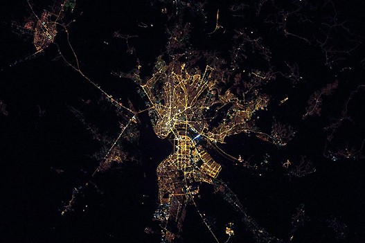
Kako li iz satelita izgleda Beograd noću? Više ne morate da se pitate jer je odgovor, to jest fotografija pred vama!

beograd-te-1.jpg


http://www.rts.rs/page/magazine/sr/.../1094432/„Satelitski+pogled“+na+Beograd+.html
 
Da, veoma lep snimak :) . Evo istog snimka pravilno orjentisanog:

hx9wtb.jpg


i još jedan stariji snimak:

belgradeserbiaseenfromt.jpg
 
Od broja 10, dole levo (što bi piloti rekli na 8 sati), je toranj na Avali. Vredi obeležavanja.
 
Da li neko zna kako je moguce na novim google mapama iskljuciti labels (ne znam kako se kaze na srpskom)?
Dakle videti samo satelitski snimak bez nacrtanih ulica, natpisa, itd...
 
Staneš mišema na "Maps" (gornji desni ugao), pojaviće se meni i u njemu odštikliraš "Labels".
 
Ja pricam o novim mapama, gde se ikona 'Maps' nalazi u donjem levom uglu. Nigde ne postoji nikakav meni. Kao da nema opcije samo satelita bez preklopljene mape.
 
https://support.google.com/maps/answer/144359

How to switch between layers

Navigate to a location in Google Maps.
Hover your mouse over the square widget on the top righthand corner of the map.
A menu with available layers for your map will appear. Click on the down arrow to view additional layers, if necessary.
Click the name of the layer that you'd like to turn on for your map (e.g. Traffic). Simply click again to turn off the layer.

Available layers

Traffic: Get up-to-date traffic conditions to find the best route to your destination.
Photos: View photos taken from locations all around the world.
Labels: Show street, city, and boundary names within your map (available when in Satellite view).
Webcams: View live imagery from webcams situated worldwide.
Bicycling: Find biking paths and trails. You can also get biking directions from Google Maps.
45º: See your location on the map at a 45º angle birds'-eye view (where available when in Satellite view).
Terrain: View the 3D elevation of natural geographic features, like mountains and canyons. Terrain view is also available for the new Google Maps.
Transit: See the public transport network of your city overlaid on the map where available.

Note: Photo Tours are currently only available in the new Google Maps for Photo Tours. Meet the new Google Maps.
samo što "square widget on the top righthand corner of the map" se nigde ne vidi, bar ne kod mene
 
Koliko je meni poznato, nove GM to ne omogucavaju. Zalilo se puno ljudi, ali Google to jos nije promenio.

Znaci samo Map i Earth mode, Terrain moze, ali Earth with no labels - ne.
 
[youtube]http://www.youtube.com/watch?v=YjS91B0Uz38[/youtube]
Пааа, искрено, очекивао сам много више од овог снимка. Шта више, нисам ни сигуран где је тачно бг :cry:
 
Ovo je pogled obrnut u odnosu kako gledamo mapu tj cizma je okrenuta. Mi smo na samom kraju snimka zagreb desno a Beograd levo na 1:22
 
Vrh